Friday, September 12, 2014


Day 14. Sept 12.

Freiburg to Donaueschingen.

Distance cycled: 47 km #
Time: 3 hrs 24 min
Speed: 13.6 km/hr
Distance so far: 1724 km
AHR: 104 b/min
Feet climbed today: 2917 ft
Punctures so far: 1
         # Weather and visibility conditions forced me to take the train for the last 30 km to Donaueschingen

Weather: Cold as I left Freiburg. Rain started after 20 km. Fog came down with the rain. Negligible wind.

Up at 6.30 this morning and as no breakfast was provided, I availed of the common kitchen to have my own version with fruit and coffee.
By 7.45 I had left and taken my place with the early cyclist-workers in the city. Freiburg is the German version of Amsterdam. Cyclists moving (at speed) in all directions. Cycle lanes provided and some shared with pedestrians. Those I met were moving swiftly in top gear and could be more dangerous than cars. Bikes (some partly dismantled) locked and parked up outside university buildings and apartments. Even the cycle lanes outside the city were busy with cyclists of all ages and styles.
 I followed the cycle paths on Holzmarkt and Walstrasse always moving east out of the city.

Within 3 km I was in the countryside and moving upstream. This cycle path (well signposted) moved , away from the river into open fields and along by the busy road.
My plan was to cycle the B31 to my destination but I became aware that cyclists are prohibited on the initial sections of that highway. So I had to come up with a Plan B fast. I picked intermediate villages on the way and followed signs for them. All went fine till I passed through and reached Buchenbach.
Here, following a signposted track, I soon found myself on a trekking trail going steeply into the fog-enshrouded hills. Nothing for it but to retreat and seek a friendlier route. Back in Buchenbach, I met with a gentleman (evidently a cyclist) who indicated a good way (apart from the dangerous B13) but with stretches of 10% gradient.
I followed his directions and took the turn for Thurber, a 9.5 km constant climb ranging from 7% to 13% with most of it touching 10%. I dug in and kept at it, never expecting that the crest/turn up ahead was the final one. It was every bit as testing (cresting at 3600 ft) as the climbs out of Tendon and out of Gerardmer on the last two days. At this stage also, the rain had become constant and the rain gear and covers were on before the climb started. Especially near the top I noticed a lot of Calvaries (I didn’t snap them) but I think that I know how Himself felt on that occasion. Fortunately, that road was very quiet and I stood out in my hi-viz.
At the top, Thurner, I joined D500 down to Breitnau and between rain, fog and smooth wet surface I was becoming concerned. This led onto the busy B31 now (cyclists permissible at this stage) and it was a nervous ride right into Titisee.
I paused a while here and weighed up the options. Safety prevailed and I decided to take the train for the last 30 km to Donaueschingen. Dealing with the German ticket machine to obtain a ticket for a bike was proving difficult but a kindly worker man assisted by explaining that all I needed was two tickets. Job done and I boarded. (The short trip would involve a change at Neustadt).
Once on the train the officious ticket inspector (lady) demanded my second ticket for the bike. She already had her credit card machine whipped out. In steps Worker Man and explains that I have two on the one ticket. Saved. At the switch in Neustadt he also guided me to the correct platform etc.
In Titisee, I was soaked and badly shivering but the heat of the carriage revved me a little.
Once off at Donaueschingen Bahnhof (it was still raining heavily) I located the hotel quickly, checked in, parked up and had the most reviving hot shower of my life.
Within an hour or so I had recovered, washed the gear (the heated towel rail in the bathroom will have all in readiness for tomorrow) and unpacked. 
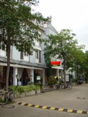
Later in the evening I had a quick walk around the town. I couldn’t get over how quiet it was for a Friday evening. And it did have plenty of upmarket shops. Generally, I have found French and German towns so far very quiet at all times of the day. No buzz.
There were some nice buildings, an impressive sculpture piece and of course, an Irish pub. (“Milan” play there next week). Seeing that Furstenberg beer is brewed here in Donaueschingen, I had to have a taste. Strong stuff at 4.8%. 
After the heights of McDonalds dinner last night I had to come down to earth tonight with Zweibelsuppe mit Gratten and Schweinachnitzel panniers mit Pommes Frites und salat for main course.
So, I suppose the rain had to come some time. Not bad considering this trip started over two weeks ago. I’m glad that we didn’t have today's weather last Friday as we set out from London.
Now, I’m on the Danube. My navigation switches to the two Bikeline guides I have, guides that give detailed distances and turns from here to Vienna. And I don’t expect any more major climbs.

I look forward with enthusiasm to the next week as much as I look back with satisfaction at the last two weeks.

Thank God for the health and for the energy.

Thursday, September 11, 2014

Day. 12. Sept 11.


Gerardmer (Fr) to Freiburg (Ger)

Distance: 103 km
Time:5 hr 20 min.
Speed: 18.2 km/hr
Distance so far:
AHR: 103 b/min
Feet climbed today: 2258 ft.
Punctures so far: 1

Weather: Cool at the start; colder at the top; very cold on the descent. Warm and sunny afternoon at 22deg. Slight headwind.

Leaving Gerardmer this morning there were many art pieces and structures relating to the Tour. Out ahead there was cloud and mist high up. 

After 6 km the climb started into the trees. First a 4 km climb at an average of 7% on a quiet road up as far as La Roche du Diable (3600 ft) with its stone arch. A few other souls (motorists) were also ther enjoying the view.

What a view. I could have stayed there much much longer. To right and left were lovely vistas. To the right was Longmer which was at the start of the climb. I didn’t really struggle on that climb once I wasn’t trying to stay with somebody.
Leaving that spot, I still had a 3km pull at 3%. Felt so much easier. Passing the 1000 m altitude mark and it was getting colder and breezier by the minute.
Finally the top arrived at Col de la Schlucht ( 3700 ft) with its ski-lift station now laid up for the off-season. Some lovely hotels in mountain style up at this point.
Came across a group of walkers parking up and arranging details before setting out and ski runs sans snow. At this stage I had put on an extra layer for the descent. Visibility wasn’t the clearest but at least I could stop anywhere I wished...no need for a pull-off.
At the start two signs caught my attention; one stating that I was now moving from Lorraine into Alsace. The other one was more pleasing - 5% descent for the next 13 km.
The road down again ran through trees and some fine views appeared. Pity that it wasn’t a clearer day. The road turned and twisted contouring around the slopes but always dropping steeply. Very little traffic in either direction.
With those extra brakes that I have it was possible to sit upright to enjoy the scenery while feathering the brakes continually. I didn’t to drop at too great a speed and I kept it at around 27 km/hr. Around me was too nice to have it pass in a blur. But hands and feet got viscously cold.
When I had descended into clear surroundings I found myself in Vallee de Munster. How about that? Further down was the town of Munster which I arrived in still freezing.
Saw plenty of tourists about and buildings and railings were all decorated uniquely. Also some interesting street furniture on the musical theme.

While I was stopped on Munster I noticed that my carry rack was wobbly. On further inspection I saw that it was broken; had snapped down near the hub so all weight was coming down on one side. I reckon that it happened on the descent where there were a few patches of rough surface. Either way something had to be done - either repair or a new one.
Luckily, I was in a town but I didn't see any bike shops around. All touristy shops in the centre where I was. Finally asked the local postman on his rounds didn’t speak English but pointed me in a direction. Soon located the family bike/motorbike shop. Only the son had some English. They saw the problem; didn’t have any carry racks that would suit and couldn’t weld as it was made of aluminium.
Finally we came on a solution with a piece of tubing obtained from a broken bike. In minutes the father had machined and drilled the piece and fitted it all back together. It feels as solid as ever. I was luck where it happened. I had lost an hour but would have been worse if the broken part had stuck into the spokes. And he didn’t charge me too much.
After Munster, I was back on flat land (no more jolting of the rack) and also grapes plentiful. Alsace produces nice white wine.
Nearing Colmar after I had gone through a roundabout I entered onto a lovely new road with a wide shoulder. I suspected something, went back a few hundred yards and spotters these signs I took it as another no-cyclists road and made my way into Colmar by a parallel road (the old original road through many villages)
Colmar was quiet for the long lunch hour and I also had my lunch there in a pizzeria. I didn’t have to wait 2 hours for service and then 3 minutes to eat up. It was actually reversed which suited me grand as I was also charging the camera batteries. (The cold  on the mountain had discharged them quicker than usual.)
Another totally flat 20 km brought me to the frontier and the Rhine. (Not my writing on the road). First over the canal with its working barges and then over the river itself. The barges moved into the locks at fast walking pace with only inches to spare.
Road signs now were different as I set out on B31. Soon I turned off this onto minor roads for my final approach to Freiburg. I was out in open quiet countryside and all went well with my cue-sheet till I came on roadworks and a detour. That threw me out and also road signs weren’t as frequent as back in France. It all resulted that I came into Freiburg from a different angle and my directions to locate the accommodation were useless.
Asked a few people to point out my location on the map and soon I pulled into my premises, rather like student accommodation. But grand for a tired body.
For my meal I legged it into the centre (20 mins) to dine high-class in McDonalds that is located in the historic city gate.
Not your typical McDonald architecture. My mission was to eat where our Sinead worked for a summer in her student days. Never thought that I’d complete that circle. Is ait an mac an saol.

Thank God for the health and for the energy.


Wednesday, September 10, 2014

Day 11. Wednesday Sept 10.


Neufchateau to Gerardmer.

Distance : 113 km
Time: 6hrs 9 mins
Speed : 18 km/hr
Distance so far: 1574 km
AHR: 109 b/min
Feet climbed today: 3672 ft. (Total 32,537 ft. Everest is 29,000+ ft)
Punctures so far: 1

Weather: Summery again. Warm and sunny up to 24 deg. Side-wind at start and then swirled in the mountains.

Felt fully recovered and fired up for today after yesterday's long haul.The body had really recovered and I felt that it had been recharging like the pulsing bars on the phone during the night hours.
At breakfast, I met up with two other cyclists from London (seniors) who were cycling from London to Venice (Italy). They had a third man driving a car and carrying luggage and they averaged 80 km per day. I left well before them after wishing them well.
In minutes I was outside of Neufchateau and already climbing while there were still darkish clouds in the sky. (No haze this morning). Within a few kms I had climbed 200 ft and had a fine view back over Neufchateau.
I was now in countryside more like our own. It was greener and more compact than earlier in the journey from Paris. More animals to be seen. At this stage I was just over 100 km north of Dijon as the crow flies. A bit far to drop down there to say hello to the friends of Tipp Co Op. Also not far from Vittel of bottled-water fame.
I moved along nicely but abided by all traffic and speed requirements (at least I thought I did) and got a big smile from the speed-sensor as I entered Dombaise en Xaintois. 
On the open road the head was down and low-flying jets (not to mention butterflies!!) found it hard to keep ahead of me as I approached Ramecourt.
I was now on a beautiful stretch of road with a fine wide shoulder (although it had long hills also). It was the safest stretch that I had been on since we entered France last Saturday.
But things were about to change as soon as a blue van with flashing blue lights and bearing the word “Gendarmerie” cut in front of me brought my progress to an abrupt halt. Two ban-gendarmes were out in a flash with hands on hips. “Bon jour, Monsieur” says one. The words wished me a good day but the eyes were saying “What the hell are you doing cycling on a road like this?”. She asked if I spoke French; I claimed my European right to conduct my affairs in Irish. We compromised on English. One of them had more English than my French, the other remained silent throughout. She explained that although this was not a motorway (“below a motorway but above a street”) cyclists were not allowed on it. I pointed out nicely that there were no signs or indications to that effect. In truth, I don’t know where I had come onto this reserved-for-motorists road. They enquire where I had started cycling and where I was heading for. My answer shook them.
I expressed my regret at violating regulations. They offered to put the bike and bags in the wagon and  bring me to the end of this stretch. While I stepped in, I got no hand on the head (!!) but I jokingly pleaded “No jail, please”.
On the short journey, just about 3 km, she asked where I came from. She’d love to come to Ireland. Asked where I lived, I mentioned Tipperary. No recognition. I started a few bars of “It’s a long way...”  “Ah, ja, ja, ja” says she with a sparkle in her eye. (I don’t expect that it was actually my singing that impressed her but the universality of our anthem.
When they droned me off at the end out came the black flip-over notebook and she asked for my identification, took down all the details and my address. Handy if she ever does come our way.
Before they left, I asked if I could take a photograph but they cited official policy. Understandable so I asked if it would be OK if I took a shot (with the camera, of course) as they pulled away. Pas de problem. Her parting words "Bon jour, Monsieur" but this time words and facial expression were in unison.
Who says that solo cycling is  tedious and boring. Always meeting interesting people. I must now behave myself till I leave France tomorrow at mid-day as my name is in the French system. Unless, they have forwarded my details to Europol !!
At this stage I was on the outskirts of Epinal and cycling along the banks of the Moselle. Not my first time as Margaret and I have cycled the German section of the same Moselle a few years back.
In the centre of the city, the quays were gaily decorated with flowers and European and other flags and mighty fountains caught the mid-day sunshine. A nice city at the centre.
Directly out of Epinal, I had a stiff 3 km climb to an elevation of 1400 ft. Roads were now shaded in and kept rising gradually, fooling the eye but not the legs (or the Garmin). I’m definitely in the Vosges Mountains.
With 86 km gone it was time to take a lunch break on Chenimenil just off my route. Bought a few soft drinks to go with my rolls and banana from the breakfast this morning. Took a seat in a deserted kids playground and enjoyed the food and the hills about. Had thoughts about an upgrade for the bike when I get back home !
Today was by far the most scenic day in France yet. Here in the Vosges it's like Wicklow; and it's high also.
This is skiing territory during the winter. At present plenty of walkers about here in Gerardmer. 
Plenty of climbs also. Near the end just out of Tendon started a climb of about 9 km with an average gradient of 6% sometimes touching 8%. It was down to the granny gear and plough along at a pace of 9 or 10 km/hr. Here I met my two friends from breakfast time again. I saw two cyclists up ahead and coming closer recognised them. I passed (have to keep your own pace going) them and one joined in behind but fell away after a short while. And they had no luggage on board. Didn’t see them for the rest of the day.
Shortly after Le Tholy, I crested a hill and Lac Gerardmer lay before me with Gerardmer at the far side. It was beautiful. It reminded of cresting and seeing Donner Lake below after the Donner Pass on the US cycle.
Nice spin into the town and I located my hotel at first attempt again. Very much a tourist town....skiing, walking and cycling.
Stage 8 of the Tour de France 2014 finished here just 1.8 km out the road; that 1.8 km stretch has an average of 10% gradient maxing at 13%. It was the first summit finish on this years Tour. I don’t expect that I’ll have a run at it in the morning.
So just another up eventful day in the life of a cycling tourist. Tomorrow I cross the Rhine into Germany.

Thank God for the health and for the energy.

PS: I believe some have been sending comments but are not appearing. I don’t know why. I’ve sent a message to Blogger re the same. Keep sending them anyhow.